


Japan’s Ministry of Land, Infrastructure, Transport and Tourism (MLIT) has unveiled a detailed Minecraft map recreating the Metropolitan Area Outer Underground Discharge Channel, commonly known as “G-Cans.” This massive flood control facility, located in the Greater Tokyo Area, is now accessible to players worldwide for free.

Explore the World’s Largest Underground Drainage System
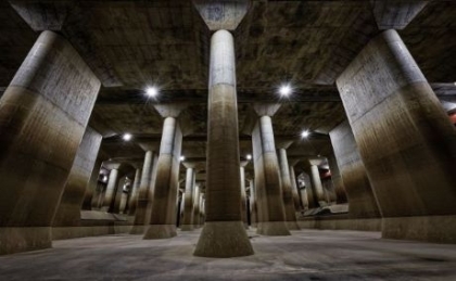
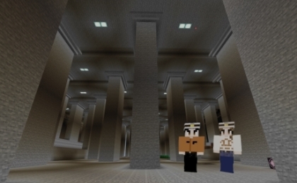
G-Cans is renowned as the world’s largest underground flood diversion facility. Its most iconic feature is the “pressure-adjusting water tank,” a vast underground chamber supported by towering 500-ton pillars, often likened to an underground temple. In the Minecraft map, this and other components like the main control room, pump room, and surrounding areas have been meticulously recreated.
Educational and Tourism Applications
The primary goal of this project is to promote disaster prevention awareness and showcase G-Cans as a unique tourist attraction. Starting in June, the map will be integrated into disaster education curricula, allowing students to interactively learn about flood control mechanisms.
Interactive Features Enhance Learning
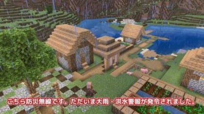
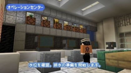
Upon entering the game, players encounter non-player characters (NPCs) simulating officials and tourists, providing comprehensive information about the facility. Users can operate simulations of water control systems, open floodgates, and observe real-time water level changes within the game environment. These interactive elements offer an immersive educational experience.
Download and Compatibility
The Minecraft map is available for free download from the Edogawa River Bureau’s official website. It supports Minecraft Bedrock version 1.21.1 and Education Edition version 1.21.03 and above. The map is compatible with PC, iOS, and Android platforms and can be uploaded to servers for cross-platform play.
Download the map here: https://www.ktr.mlit.go.jp/edogawa/edogawa01318.html